Mt. Lemmon Highway: Emergency Repairs
Location: Tucson, AZ
Client: Pima County DOT
Status: Completed

The 2006 monsoon season was the 6th wettest on record for the Tucson Arizona area. The worst storm to hit the region was on July 31 of 2006. Ground already saturated by previous storms allowed significant runoff and the storm caused flooding of the Rillito and Santa Cruz rivers and flooding, slope failures and debris flows in the Santa Catalina Mountains.
According to an Arizona Daily Star article (“Sabino Canyon’s New Scars”, Tom Beal, 9/21/06), up to 6 inches of rain fell in a 7 hour period of the early morning hours of July 31. The article cites the National Weather Service spokesman who indicated the storm was “more than a 100-year event”.
USGS sources in the article reported that 240 new slope failures have been mapped in the Santa Catalina Mountains in the vicinity of Sabino Canyon where only 5 were mapped previously. They indicated that the Catalina Mountains have not eroded in this fashion in close to 10,000 years!
The Mt. Lemmon (Catalina) Highway was significantly effected by storm as well, with debris flows, rock fall, portions of the road washed out, slope failures, and the failure of an MSE retaining wall. NCSG was contacted by Pima County on August 1st and went out to the site to survey the damages with the county the same day.
Through our As-Needed Geotechnical Services contract with Pima County Department of Transportation (PCDOT), NCSG was tasked with providing recommendations for emergency remediation of two specific areas, a retaining wall failure near MP 9.8, and a slope failure that undermined portions of the guardrail near MP 3.8.
This emergency project was given our highest priority and within the week we had mobilized a drill rig to perform an investigation at the two sites. Verbal recommendations were provided within 10 business days of being issued the assignment, and a formal letter report was issued shortly thereafter.
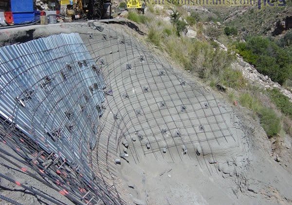
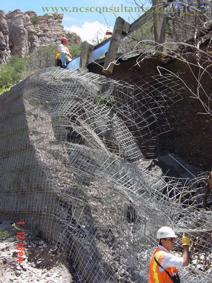
Our recommendations involved a soil nail wall fix of both sites. In the case of the MSE wall failure at MP 9.8, a temporary wall was designed as the County determined a bridge would be designed at that location to prevent similar incidents from occurring again. The site at MP 3.8 was to be a permanent soil nail wall, with form work used to pour a 2-sack slurry “block” to allow for the guardrail to be replaced. The block was be structurally connected with the soil nail wall and/or doweled into the slope.
The work at both (MP 3.8 and MP 9.8) sites was successfully completed and the project is in service.
- Emergency repair of 2 sites damaged in July 31, 2006 monsoon storms
- Recommendations provided within 10 business days of receiving the task order
- A soil nail fix was designed to stabilize both sites
- NCS provided start to finish design and construction inspection services


